Travel / Tourism Spots in Mt. Ishizuchi / Shikoku Karst Area
Area
-
-
Ehime


-
-
Ehime
-
-
Mt. Ishizuchi / Shikoku Karst
-
Mt. Ishizuchi / Shikoku Karst

Category
-
- Ishizuchi Skyline
- Travel / Tourism
- Ehime Pref. Kamiukenagunkumakougenchou Wakayama
- A driving route that runs around 18 kilometers and connects Omogo Gorge with the Mt. Ishizuchi trailhead. Confront the majesty of Mt. Ishizuchi as you run up the 850 meters elevation gain to the lodge at the mountain trailhead. On clear days you can stop mid-way at the Nagaone Viewing platform to see Goraiko Waterfall, one of Japan's 100 Best Waterfalls. There's also a spot to look at the majestic sight of Tengudake peak, the tallest point of Mt. Ishizuchi. This is also a well-known famous place to view the autumn colors and from the beginning to the end of October lots of tourists visit to pass through the colorful tunnel of leaves.

-
- Kiri-no-Mori Roadside Station
- Transportation
- Ehime Pref. Shikokuchuoushi Shinguchoumatate 4491-1
- A roadside station in Shingu Town, Shikokuchuo City, Ehime Prefecture surrounded by forest with local produce on sale, a restaurant, cafe and cake shop. In the restaurant, the cha-soba made with Shingu green tea, and the kiri-no-mori roll cake, are popular choices. For souvenirs, the kiri-no-mori daifuku cake made with a copious amount of local matcha green tea is especially famous, often selling out on the holidays and weekends and in the early part of the new green tea season. There is also an onsen so guests can enjoy a relaxing hot spring bath and cottages for accommodation on site.

-
- Omogo Mountain Museum
-
![rating-image]() 4.03 Reviews
4.03 Reviews - Leisure / Hobbies
- Ehime Kamiukena-gun Kumakogencho Wakayama 650-1
- This museum is located in Wakayama, Kumakogen Town, Kamiukena County. Its permanent collection features around 3,000 exhibits on a variety of subjects. These include the plants and animals that inhabit the Ishizuchi mountain range, the geology of Mt. Ishizuchi and the Omogo Gorge, and the history and folk culture of the area including mountain worship. The museum also holds three special exhibits each year as well as events such as nature observation parties and entomology seminars.
-
![]()
石鎚山面河峡谷の自然をいろんな視点で解説展示していました。毎年の企画展も興味深いテーマで楽しめました。

-
- Mezurudaira
- Travel / Tourism
- Ehime Pref. Kamiukenagunkumakougenchou Nishidani ・ Kohara-cho, Takaoka-gun, Kochi Prefecture
- One of Japan's three best karsts alongside Akiyoshidai in Yamaguchi Prefecture and Hiraodai in Fukuoka Prefecture. It's located along the border to Kochi Prefecture nearly three kilometers from Jiyoshi Pass. As you leave the pass and reach the peak on this popular driving course your field of view suddenly widens and you'll find facilities such as a parking area and a camp ground. Alpine plants bloom across the flat plain during the summer and from spring to fall you'll see cattle grazing. The soft serve ice cream sold at ''Mezuruso'', marked by its peaked roof, has a reputation for being rich an addictive.

-
- Kuma Kogen Astronomical Observatory
-
![rating-image]() 4.52 Reviews
4.52 Reviews - Leisure / Hobbies
- Ehime Kamiukena-gun Kumakogencho Shimohatanokawa Otsu 488
- This astronomical observatory is located in Shimohatanokawa, Kumakogen Town, Kamiukena County. It features an observatory equipped with a 60-centimeter reflecting telescope as well as a small 40-seat planetarium. Visitors can enjoy observing the shining stars over the highlands with expert commentary at the observatory’s nighttime stargazing parties (reservation required). Visitors can see a planetarium show every day in the daytime (except when the observatory is closed).
-
![]()
家族でうかがったのですが、土星もばちり見えました! あとこの日は天の川も綺麗にみることができて子供たちも大興奮。 天体好きにはたまらないと思います。

-
- Minetopia Besshi Tohnal Zone
- Travel / Tourism
- Ehime Pref. Nihamashi Tatsukawachou 654-3
- Often referred to as the Machu Picchu of the East, these plains can be found in the mountains at an altitude of 750 meters. Because the Besshi Mining headquarters were located here from 1916 to 1930, the area has the makings of a town, with company housing, an elementary school, and a reception building. There’s a large brick building still standing as well, and the Tohnal Historical Museum features exhibitions on the culture of the period and the Besshi copper mines.

-
- Suiha Kogen Highland
- Travel / Tourism
- Ehime Pref. Shikokuchuoushi Kinshachouhiranoyama
- This highland in Shikokuchuo City centers around Mt. Suihamine and sits almost 890 meters above sea level. Enjoy a fantastic 360-degree panoramic view of various islands in the Seto Inland Sea and the Shikoku mountain range. Come see the amazing scenery of golden rapeseed flowers covering the land in spring or cosmos flowers from summer to early fall. This is also a popular cherry blossom viewing location as from mid-April to May the Yoshino cherry, hill cherry, and double-flowered cherry are all in full bloom. There is also a children's area with a playground, toilets, and a parking lot. Many tourists visit during the spring when the flowers bloom like a carpet.

-
- Kawanoe Castle
- Travel / Tourism
- Ehime Pref. Shikokuchuoushi Kawanoechou
- This castle located on Mt. Washio (Mt. Shiroyama) in Kawanoe Town was originally a Buddhist temple and is also known as Butsuden Castle. Little remained of the stone gate near the keep in the Showa period (1926-1989), but with the 30th anniversary of Kawanoe City, the castle tower, watchtower, barbican, turrets and fences were reconstructed in its present state. Besides being able to see all over the islands in the Seto Inland Sea from the castle keep, armor and helmets from the Sengoku period (1467-1603 as a rough guide) are also on display. In addition, known as a popular cherry blossom viewing spot, the Sakura Matsuri is held there in the spring.

-
- Omogo Gorge
- Travel / Tourism
- Ehime Pref. Kamiukenagunkumakougenchou Wakayama
- "This gorge spreads out near the foot of Mt. Ishizuchi upstream on the Niyodo River in Kochi Prefecture where the clear blue ""Niyodo blue"" has gained attention. The river that flows there is very clear, and you can see all the way to the riverbed. There are two main promenades, the main route connecting sights such as Goshiki-gawara Riverbed, Momiji-gawara Riverbed and Torigataki Falls, and the Teppo route along the quiet Teppo River. The surrounding forest has also been selected as one of the Top 100 Forested Water by the Forestry Agency, and is also known as a nationally designated scenic spot. How it looks changes in various ways depending on the season, and it is also popular as a spot for seeing colorful leaves in the autumn."

-
- Kuma Museum of Art
-
![rating-image]() 2.01 Reviews
2.01 Reviews - Leisure / Hobbies
- Ehime Pref. Kamiukenagunkumakougenchou Sugou Second cropland 1442-7
- Located approximately 40 minutes on National Route 33 towards Kochi from the Matsuyama Interchange on the Matsuyama Expressway, this museum on wooden architecture that houses and exhibits mainly a collection donated by the Kuma-born businessman late Yoshiharu Ibe. In addition to permanent exhibitions such as oil paintings by Ryusei Kishida, representative of Japanese modern Western painting, and Tetsugoro Yorozu, and Japanese calligraphy, ceramic works and sculpture works, it holds collection exhibits with a theme two to three times a year. You can enjoy seasonal scenery such as the oriental paperbush and sasayuri (Japanese lily) in the wild grass and flower garden, and there is also a guest rooms that entertain Pilgrims.
-
![]()
国道33号線久万中学前交差点を県道12号線へ曲がり物産館の所で右折した丘の上に駐車場もあります。同町縁の実業家が寄贈したコレクションに由来するとか。「孤高の道 馬越舛太郎」展が開催されていました。料金800円。入口で靴を脱いで館内に入りますが、スリッパは無。展示室はワンフロア。萬鉄五郎や藤田嗣治、村山槐多の作品も収蔵していると聞きましたが、訪問時に展示なし。15分一本勝負でトイレタイムと併せてサク...

-
- Namegawa Gorge
- Travel / Tourism
- Ehime Pref. Touonshi Myouga
- This hinterlands valley is around 8 kilometers from the famous cherry-blossom viewing area, Sakura-Sanri, along National Route 11. Come experience the mysteries of nature in this valley and see the Namera, a river bed made from one large spacious rock that stretches almost a kilometer in length, as well as potholes formed by smaller stones caught in the whirlpools cutting into the larger boulders. A popular spot in the spring when the new verdant green leaves emerge and during the summer as a cool place to escape the heat. With amazing autumn colors in the fall and icicles stretching longer than two meters in the winter, there's something to enjoy here year-round. This valley with its mysterious rockface formed over countless years has certainly earned its reputation as a secluded natural power spot (spiritual place with energy vortex).

-
- Shirai Falls
- Travel / Tourism
- Ehime Pref. Touonshi Kawanouchi
- This famous waterfall has been repeatedly featured in short literary works and verses by great haiku poet s including Masaoka Shiki and Natsume Soseki. Located in Saragamine Mountain Range Prefectural Natural Park, this majestic waterfall cascades a distance of 96-meters. Parking facilities, an esplanade to the waterfall, and a viewing platform make it possible for anyone to visit. The Shirai Falls Festival is held every year on November 3rd, and with the nearby trees dyed in autumn splendor, mochi dumplings are tossed to the crowd while local produce is available for purchase. During the winter the entire falls freezes over, giving it the wondrous appearance of an ice sculpture.

-
- Uchinuki
- Travel / Tourism
- Ehime Pref. Saijoushi Kambai
- Fountains, known as uchinuki which feed off of Saijo City's underground water reservoir. Good quality spring water which is exposed to pressure wells up through the iron pipes that were driven into the underground reservoir. There are said to be almost 3,000 such springs throughout the city and some 90 thousand tons rush forth on a daily basis. As the water temperature rarely changes, it is used in modern times for a variety of purposes including daily activities, farming irrigation, and manufacturing. It's also famous for its drinkability and earned first place at the 1995 All-Japan Water Tasting event. Many people visit the fountains located on the western side of the Saijo-city Sogobunkakaikan Hall, the Uchinuki park on the left bank of the Kamo River, or the Kamo-jinja Shrine to try the famous water for themselves.

-
- Furuiwaya
- Travel / Tourism
- Ehime Pref. Kamiukenagunkumakougenchou Naose
- These giant conglomerate stone spires, which towers over its surroundings and has some 20-million years of stratum, has been the nationally designated Place of Scenic Beauty. The sight of 20-some strange spires ranging in height from 60 to 100 meters tall will take your breath away. The naked rock face has had countless holes carved into it by water erosion over the years, leading to it being named Furuiwaya. Known for beautiful autumn colors, tourists flock to the area when the trees start changing in early November to see the contrast between the vivid fall colors and the unyielding rock face.

-
- Mt. Ishizuchi
- Travel / Tourism
- Saijo City, Ehime Pref.
- At 1,982 meters tall this sacred mountain, also called the roof of Shikoku, is the tallest mountain in west Japan. It stands over Saijo City and Kumakogen Town and from the highest point, Tengudake peak, you can of course see the Seto Inland Sea but also the mountains in the Chugoku and Kyushu regions. It is counted alongside Mt. Fuji, Mt. Tateyama, Mt. Hakusan, Mt. Shakagatake, Mt. Omine, and Mt. Daisen as one of Japan's Seven Holy Mountains. The area around Mt. Ishizuchi has been designated a quasi-national park and displays a different mysterious form every season. The four separate chained areas for climbing the mountain are a rarity nationwide. As there are detours it is safe even for beginners.

-
- Seiryu-ji Temple
- Travel / Tourism
- Ehime Shikokuchuo Shingucho Umatate 1200
- The 13th temple of Shikoku Bekkaku 20 temples Pilgrimage. It is also called the inner shrine of Sankakuji Temple, number 65 of 88 sacred places on the Shikoku Pilgrimage. It has long been called the sacred mountain where dragons nest, brings good fortune, wards off evil, and protects crop yields from insects, attracting ceaseless visitors. In the depths of the rock the Fudo Myoo (Acalanatha) and the local Shinto deity Takizawa Daigongen are enshrined and this is the 26th of Shikoku 36 Fudo Myoo temples Pilgrimage. The temple is about a 25-minute drive from the Shingu Interchange on the Kochi Expressway. The steep cliffs and old growth forest that surround the grounds make it so that larger buses cannot reach the temple.

-
- Godan Kogen Highlands
- Travel / Tourism
- Ehime Pref. Kamiukenagunkumakougenchou Nishidani
- Also known as ''Heaven's Road'', this highland runs alongside Prefectural Route 383. You can walk here from Mezurudaira, located in the center of the Shikoku Karst. The peak, sometimes called Godan Castle, sits almost 1,456 meters above sea level. On clear days you can see Mt. Ishizuchi, Tosa Bay, and the Shikoku mountain range. The highland is well deserving its title as the foremost viewing spot of the Shikoku karst with the ''Karrenfeld'' exposed limestone rocks and a basin-like ''doline'' sinkhole. The road has been chosen as one of the top 100 roads of Japan with its beautiful scenery that makes you feel like you're amongst the beautiful blue sky and pure white clouds.

-
- Mt. Kamegamori
- Travel / Tourism
- Saijo City, Ehime Prefecture, Kamogawa-gun, Kochi Prefecture
- This mountain, a two-hour drive from the Iyo-Komatsu Interchange on the Matsuyama Expressway, has been selected as one of the 300 Famous Japanese Mountains. The peak sits at 1,897 meters above sea level with a plain spread across the peak. The contrast and beauty between the fir and Japanese hemlock and the sun-bleached stumps earns this area's name of Shikoku's Panorama Platform. The local road Kamegamori line, commonly called the UFO Line (Yuho Line), is a beautiful 27 kilometers driving route with Mt Ishizuchi, west Japan's tallest holy mountain, in the background. On clear days you can see as far as the Pacific Ocean and the road has been used for TV commercials. It's a popular mountain for beginner climbers and the summit can be reached in one hour from the trailhead.

-
- Lake Kurose
- Travel / Tourism
- Ehime Pref. Saijoushi Kurose
- Located an approximately ten-minute drive from Kamogawa Bridge or approximately 30 minutes by bus from Iyo-Saijo Station on the JR Yosan Line, this multipurpose dam lake for Kurose Dam dammed up the Kamo River and was completed in 1973. There are two parks, No. 1 Park and No. 2 Park, and many people visit for picnics, hiking and bass fishing. Cherry trees are planted along the vicinity of the lake, and in the spring you can enjoy the scenery with fresh greenery and cherry blossoms reflected in the lake's surface. It has been designated as a special protected area as a destination for the endangered Baikal teal.
-
- Ajisai Road
- Travel / Tourism
- Ehime Shikokuchuo Kinshacho-Tomisatocho
- This stretch of road running from the National Route 319 Houo Tunnel in Shikokuchuo City to the Besshiyama District in Niihama City is famous for its hydrangeas. Some 30,000 hydrangeas have been planted along its roughly 15-kilometer length. A park, Shimonagase Hydrangea Park, has also been built along the road. Every June it hosts the Reinan Hydrangea Viewing Festival.


Ehime Areas
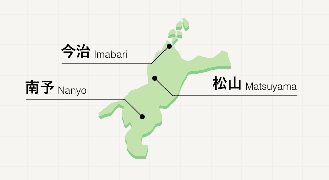
Stretched across the northwest corner of Shikoku island, Ehime is a nature-rich prefecture boasting beautiful coastlines and a rural center where mountains play host to 26 of the Buddhist temples that make up the Shikoku Pilgrimage. Matsuyama is home to an original post-feudal castle as well as Dogo Onsen, one of the country’s oldest natural hot springs. The northern city of Imabari marks the entrance to the Shimano Kaido, a road that crosses six spectacular bridges and several islands, forming a route between Shikoku and mainland Honshu.
Ehime Photo Album
Best of Ehime
Search by Region
-
- Hokkaido / Tohoku
- Hokkaido
- Aomori
- Iwate
- Miyagi
- Akita
- Yamagata
- Fukushima
-
- Kanto
- Ibaraki
- Tochigi
- Gunma
- Saitama
- Chiba
- Tokyo
- Kanagawa
-
- Koshinetsu / Hokuriku
- Niigata
- Toyama
- Ishikawa
- Fukui
- Yamanashi
- Nagano
-
- Tokai
- Gifu
- Shizuoka
- Aichi
- Mie
-
- Kinki
- Shiga
- Kyoto
- Osaka
- Hyogo
- Nara
- Wakayama
-
- Chugoku
- Tottori
- Shimane
- Okayama
- Hiroshima
- Yamaguchi
-
- Shikoku
- Tokushima
- Kagawa
- Ehime
- Kochi
-
- Kyushu / Okinawa
- Fukuoka
- Saga
- Nagasaki
- Kumamoto
- Oita
- Miyazaki
- Kagoshima
- Okinawa


