Rock Spots in Kushimoto / Koza / Susami Area
Area
-
-
Wakayama


-
-
Wakayama

Category
-
- Hashikuiiwa Rocks
- Travel / Tourism
- Wakayama Prefecture Higashimuro-gun Kushimoto-cho Hashikui
- The Hashikuiiwa Rocks are about 40 rocks of various sizes in a row towering over the seashore from Kushimoto heading towards Oshima. The name comes from the fact that the row of rocks stretching for about 850 meters looks as though bridge piles have been left on the shore. At low tide visitors can walk to Bentenjima Islet which is nearly in the middle of the row. In addition to this sightseeing spot being selected as one of Japan’s 100 best places to watch the sunrise, as it is popular to watch the sun rise over the Hashikuiiwa Rocks, it has also been designated as a National Place of Scenic Beauty and a Natural Monument.

-
- Umikongo
- Travel / Tourism
- Wakayama Pref. Higashimurogunkushimotochou Kashino
- Named after Mt. Kumgang, a Place of Scenic Beauty on the Korean Peninsula, this picturesque scenery features a series of precipitous cliffs. The sight of the huge rocks rising perpendicularly almost like a pyramid with raging waves smashing against the cliffs makes for a powerful sight. The Japan-U.S. Friendship Memorial Museum on the premises has displays of photos and a diorama which tell about the time when two US merchant ships, the Lady Washington and the Grace, landed at Oshima.

-
- Ichimai-iwa Monolith
- Travel / Tourism
- Wakayama Higashimuro-gun Kozagawa Cho Aise
- "This huge crag towers along the Kozagawa River and has been designated a National Natural Monument. The cliff can be seen from Roadside Station Ichimaiiwa on National Route 371 on the other side of the Kozagawa River. Roughly 100 meters tall and 500 meters wide, it is one of the largest single blocks of bedrock found in Japan. In the Edo period ""Kii zoku fudoki"" chronicle, it is described as ""A truly sacred place and perhaps the most amazing sight in the world."" Visitors can also enjoy the changing seasonal beauty of the cherry trees, Tricyrtis macranthopsis, and other plants which grow in the area. A campground sprawls along the river and in the summer the area bustles with campers."

-
- BotanIwa
- Travel / Tourism
- Wakayama Higashimuro-gun Kozagawa Cho Tsukinose
- "This intriguing rock formation is located southeast of the Kozagawa Dike, a 22-kilometer-long stretch of the 56-kilometer-long Kozagawa River formed via ancient volcanic activity. The rock surface, carved out by the actions of the wind over eons, is covered in holes, and small mounds of various sizes can be seen rising up within these same holes. The name of the formation literally means ""Tree Peony Rock"" and is derived from the resemblance of these holes and mounds to tree peonies. According to local legend, a great snake lived on the opposite shore, and in order to pass by the rock formation without being attacked by the snake, one would have to cough and clear one's throat before walking by."

-
- Tenchugan
- Travel / Tourism
- Wakayama Higashimuro-gun Kozagawa Cho Kurozu
- This rock formation is located just on the west side of the Ichimai-iwa Monolith, one of the most famous sights along the Kozagawa Dike, a 22-kilometer-long stretch of the 56-kilometer-long Kozagawa River which was formed via ancient volcanic activity. Sticking out like a peninsula among the mountains, seen from below, the stunning rock formation exudes a majestic air. Amidst greenery-covered mountains, this chunk of rock, although bearing trees in some places, is largely uncovered stone, and its spectacular form, thrusting towards the heavens, impresses upon viewers the power of nature.

-
- Mushikui-iwa Rock
- Travel / Tourism
- Wakayama Higashimuro-gun Kozagawa Cho Ikenoyama
- "A 10-minute drive from JR Koza Station. This rock formation is located right next to Roadside Station Mushikui-iwa and has been designated a National Natural Monument. The name of the formation could literally be translated as ""Moth-eaten Rock,"" and just as its name suggest, the huge mass of liparite has been eroded by wind and rain resulting in holes which make it look like moth-eaten cloth. It is believed the curious erosion pattern is a result of minute crystals forming when water evaporates on the rock; this in turn results in the surface of the rock slowly being removed. A part of the natural Kozagawa Dike, an area selected for inclusion in a list of Geology 100 selections of Japan, legend has it that visiting the formation aids in the healing of ear ailments."

-
- IimoriIwa
- Travel / Tourism
- Wakayama Higashimuro-gun Kozagawacho
- "This rock formation is located east of the Ichimai-iwa Monolith, one of the most famous sights along the Kozagawa Dike, a 22-kilometer-long stretch of the 56-kilometer-long Kozagawa River which was formed via ancient volcanic activity. The formation can just be seen amidst the mountains from the Tachiai Bridge along National Route 371. Its name literally means ""Rice Mound Rock"" and is derived from its resemblance to a heaping mound of cooked rice. Be sure to check it out along with the numerous other sightseeing destinations along the Kozagawa River."

Wakayama Areas
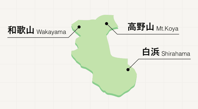
Wakayama prefecture unites pilgrims, food lovers, and culture buffs in a tranquil corner of Japan at the base of the Kii Peninsula. The setting for many a Kumano Kodo pilgrimage trail, Wakayama invites those in search of spirituality from one side of the prefecture to the other, from the 100-plus Buddhist temples of the sacred Mount Koya in the west to the inspiring temples of the Kumano Sanzan set among breathtaking nature in the east. Once the grueling hike is complete, make a beeline for Wakayama city to savor some of the country’s most delicious ramen noodles.
Wakayama Photo Album

Best of Wakayama
Search by Region
-
- Hokkaido / Tohoku
- Hokkaido
- Aomori
- Iwate
- Miyagi
- Akita
- Yamagata
- Fukushima
-
- Kanto
- Ibaraki
- Tochigi
- Gunma
- Saitama
- Chiba
- Tokyo
- Kanagawa
-
- Koshinetsu / Hokuriku
- Niigata
- Toyama
- Ishikawa
- Fukui
- Yamanashi
- Nagano
-
- Tokai
- Gifu
- Shizuoka
- Aichi
- Mie
-
- Kinki
- Shiga
- Kyoto
- Osaka
- Hyogo
- Nara
- Wakayama
-
- Chugoku
- Tottori
- Shimane
- Okayama
- Hiroshima
- Yamaguchi
-
- Shikoku
- Tokushima
- Kagawa
- Ehime
- Kochi
-
- Kyushu / Okinawa
- Fukuoka
- Saga
- Nagasaki
- Kumamoto
- Oita
- Miyazaki
- Kagoshima
- Okinawa


