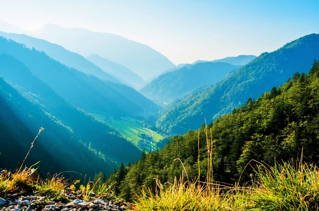
Mt. Akagi
Located practically in the center of Gunma Prefecture, this polygenetic volcano is considered one of the most beautiful in the Kano region as well as one of the 100 most beautiful mountains in Japan. From May to July, a diverse variety of azalea species come into bloom, dying the mountain lovely colors. A variety of other activities can be enjoyed on the mountain throughout the year—in addition to mountain climbing, there's camping, hill climbing, trail running, wildlife observation and activity programs, and in winter, there's snowshoeing and pond smelt fishing on frozen Lake Onuma.
Spot details


- Address
-
Gunma Pref. Maebashishi Fujimimachiakagisan

 Map
Map
- Area
- Central Area
- Course1
- Mt. Kurobi - Komagatake: This trail leads from the Obora Komagatake trailhead next to Obora Onoko parking lot over Mt. Komagatake and Mt. Kurobi back to Obora Komagatake trailhead. The trail climbs to 464 meters, is 4.9 kilometer round trip, and takes about 3 hours and 30 minutes. The ridge course from Mt. Komagatake to Mt. Kurobi is the most popular hiking course on Mt. Akagi, and is not particularly difficult. After passing the steep slope covered in monotone bamboo grass, you suddenly see a long iron staircase. After a long, hard rocky climb, you are rewarded with a panorama view of the area mountains including Mt. Tanigawa, Mt. Sukai on the Joetsu border, the Okunikko Mountains, Hiuchigatake, and Mt. Joshu Hotaka. When the weather is good, you might see Mt. Fuji or the distant southern Alps.
- Course2
- Mt. Suzugatake: The Suzugatake trailhead is near Shirakaba Ranch, famous for Japanese azaleas. The trail climbs to 155 meters, is 4.6 kilometer round trip, and takes about three hours. After passing the small peak of Mt. Ubakoyama, you descend back toward Kuwagara Pass. The view toward Mt. Jizodake towering over the end of Onuma is spectacular. When you reach the summit of Mt. Kuwagara, you'll find an outstanding view of Mt. Suzugatake in front of you and behind Mt. Tanigawa and Mt. Hotaka. The view from here is so good, and the natural woods so lovely, it's loved by hikers of all skill levels, making it one of Gunma prefecture's leading courses.
- Course3
- Mt. Jizodake: This trail starts from Obora Parking Area, passes Mt. Jizodake and Haccho Pass before returning to Obora Parking Area, for a round trip of 3.5 kilometers taking about two hours. This trail offers Mt. Akagi's widest view, with a panorama of Mt. Kurobi, Mt. Suzugatake on the north, and the Kanto Plain on the south. Mt. Akagi's first order triangulation point isn't the highest peak of Mt. Kurobi, but here, on the summit of Mt. Jizodake. Itto Sankakuten Kenkyukai chose Mt. Jizodake as one of Japan's top 100 Triangulation Points for standards such as appearance, view, and climbing difficulty. The summit once hosted a Jizodo hall, which held gold-copper allow statues of Jizo by the beginning of Meiji period, but none now remain.
- Course4
- Miyama - Akagi Campground - Foot of Mt. Suzugatake: Leaving from Miyama, this trail passes through a larch forest on to Akagi campground, then continues to the foot of Mt. Suzugatake. It's a 12 kilometer round trip, taking about three hours. The area around Akagi Campground is embraced by a beautiful larch forest, and the foot of Suzugatake is overgrown with kumazasa bamboo grass taller than human height, giving this trail a deep woodland atmosphere. You can get to Akagi campground by car, and walk to the foot of Mt. Suzugatake from there, too. When you pass the foot of Mt. Suzugatake, the view opens up to take in virgin forests of Mongolian oak and Japanese white birch.
Information Sources: NAVITIME JAPAN
![[Dogs OK] 20 minutes from IC! Packraft canoe experience tour at Lake Sonohara *Gunma, Oze, Oigami](https://img.activityjapan.com/10/23055/10000002305501_nlgeXDD0_4.JPG?version=1688885664)
![[Gunma/Midori City, Kiryu City] SUP experience ・One guide per group ・Available from elementary school students ・Tea time with SUP](https://img.activityjapan.com/10/36854/10000003685401_JJlfVBh1_4.jpg?version=1650273307)