Travel through Kochi Prefecture on Japan’s Shikoku Island and you’re bound to see images of its famous samurai Sakamoto Ryoma (1836–1867), a famed revolutionary who is perhaps Kochi’s greatest claim to fame. But there’s a lot more to this crescent-shaped prefecture embracing Tosa Bay on the Pacific Ocean, especially when it comes to eco-tourism.
-
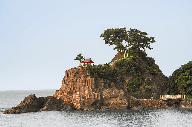
![Watatsumi Shrine is a Shinto sanctuary that commands vistas of the Pacific Ocean]()
Watatsumi Shrine is a Shinto sanctuary that commands vistas of the Pacific Ocean
Kochi has a lush natural landscape that encompasses its long Pacific coast and the densely forested interior. The prefecture is about 84% woodland, which covers lowlands and mountains to the north. The 196-km-long Shimanto River is noted for its clear waters and for being one of the few major rivers in Japan without dams. From beaches to mountaintops, Kochi offers a multitude of opportunities to soak up its natural charms. In this article we will introduce a selection of hand-picked locations that offer stunning views and plenty of excellent photography.
![Katsurahama Beach, south of Kochi City offers a nice stretch of sandy beach with picturesque views of Watasumi Shrine perched on the clifftop at the far end of the beach]()
Katsurahama Beach, south of Kochi City offers a nice stretch of sandy beach with picturesque views of Watasumi Shrine perched on the clifftop at the far end of the beach
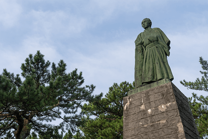
![A statue of the 19th-century revolutionary Sakamoto Ryoma also looms over Katsurahama Beach]()
A statue of the 19th-century revolutionary Sakamoto Ryoma also looms over Katsurahama Beach
-
02
Katsurahama Beach
A perfect place to begin exploring Kochi is Katsurahama Beach, on the Ueryuzu Cape south of Kochi City. Unfortunately here is no swimming allowed here due to strong ocean currents, but it’s a very relaxing and picturesque spot. Here you’ll find an iconic statue of Sakamoto gazing out to the Pacific, set in a grove of pine trees as well.
To learn more about this influential figure who wanted Japan to cast off feudalism and embrace modernity, visit the nearby Sakamoto Ryoma Memorial Museum beside the Katsurahama Aquarium. At the opposite end of the beach, Watatsumi Shrine is a Shinto sanctuary set on a rocky promontory with sweeping ocean views.![Harvest time: Green-gold rice fields lined with red spider lilies in rural Kochi Prefecture]()
Harvest time: Green-gold rice fields lined with red spider lilies in rural Kochi Prefecture
Katsurahama Beach: Katsurahama Park, Urado, Kochi Prefecture 781-0262
-
03
Rice fields and waterfalls a plenty
Moving deeper into Kochi, travelers will pass an array of jaw-droppingly beautiful landscapes including traditional farming villages, river valleys and golden rice paddies. Approaching the mountains, there are a number of eye-popping waterfalls as well, that offer both ideal photography opportunities and excellent spots to de-stress and absorb the negatively charged ions floating in the air; some researchers have suggested these tiny particles have mental health benefits.
![The approach to Nagasawa Falls is a world of deep greenery]()
The approach to Nagasawa Falls is a world of deep greenery
![Nagasawa Falls is a 34 meter tall waterfall with a 15 meter wide pool at its base, tucked away in a forest]()
Nagasawa Falls is a 34 meter tall waterfall with a 15 meter wide pool at its base, tucked away in a forest
In the Takaoka district, a short drive off National Route 439, which runs roughly east-west and connects Tokushima City with Shimanto City, Nagasawa Falls is approached by a mossy bridge. This stunning cascade is 34 meters tall, with clear waters issuing from a heart-shaped hole. The pool at the base of the falls, some 15 meters wide, is surrounded by tall boulders. According to legend, tossing metal into the pool will bring rain the following day.
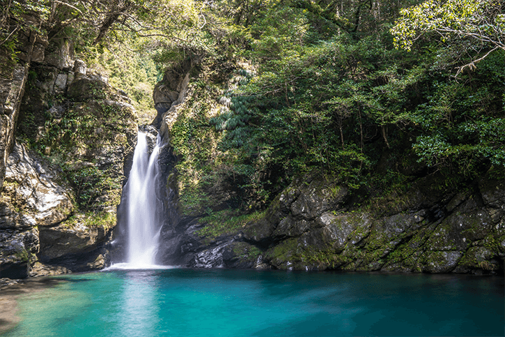
![Nikobuchi is a sacred pool with stunning blue waters and a beautiful waterfall]()
Nikobuchi is a sacred pool with stunning blue waters and a beautiful waterfall
Following 439 farther north into the mountains to Ino Town, turning onto National Route 194 brings you to another natural wonder: Nikobuchi. Also known as Niko Deep, this is a dazzling pool renowned for its deep blue color, dubbed Niyodo Blue because it is part of a tributary to the Niyodo River. As the sun’s angle shifts during the day, different shades of blue can be seen in the water. Fed by a short waterfall, the pool is a sacred site, said to be the dwelling of a serpentine water god; entering the water is forbidden. Nikobuchi reached via a steep staircase descending from the road. Note that observing the pool at the bottom of the stair is done on large boulders, which may be challenging for some visitors, so approaching with care and caution is advised - what awaits you at the bottom is some of the best waterfall photography around!
Nagasawa Falls: Tsuno, Takaoka District, Kochi Prefecture 785-0504
Nikobuchi (Niko Deep): 2976-11 Kiyomizukamibun, Ino, Agawa District, Kochi Prefecture 781-2511
-
04
Mountaintop roads
![Driving along the backbone of Shikoku on the UFO Line]()
Driving along the backbone of Shikoku on the UFO Line
Kochi features some unique mountaintop roads that afford astonishing vistas from above a sea of cloud (unkai in Japanese). Ino Town is home to a panoramic drive accessed from National Route 194. The UFO Line, aka Kamegamori Woodland Town Road, is a 24-kilometer road stretching across forested mountainsides and breathtaking ridges. The UFO Line winds along at 1,300 to 1,700 meters above sea level, the highest point in the Shikoku mountains. On clear days, motorists, motorcyclists and cyclists can see the Ishizuchi mountains and as far as Tosa Bay to the south. In May, the Akebonotsutsuji azalea (Rhododendron pentaphyllum), blooms with striking pink-white flowers. The area is especially beautiful in autumn when the mountains turn crimson, orange and gold. There are hiking trails leading away from rest areas along the route, including to easily scaled peaks such as Higashi Kuromori (1,735 meters). From these peaks, stunning views across the ridgeline can be easily seen on a clear day.
![Zipping along the Shikoku Karst road]()
Zipping along the Shikoku Karst road
![Shikoku Karst offers views of rolling hills with a backdrop of rugged mountains]()
Shikoku Karst offers views of rolling hills with a backdrop of rugged mountains
Kochi’s other great highland drive is in the western part of the prefecture along the border with Ehime Prefecture. The Shikoku Karst refers to mountaintop topography formed by the erosion of limestone. Running through the Tengu Highlands, a 25-km expanse of rocks and grasslands, National Route 383 is designated as one of the 100 most scenic roads in Japan. The panorama stretches from the Pacific Ocean in the south to the Ishizuchi mountain range in the north.
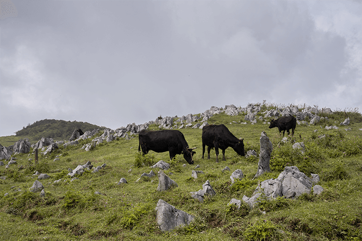
![Cattle grazing on the Tengu Highlands’ Shikoku Karst region]()
Cattle grazing on the Tengu Highlands’ Shikoku Karst region
These rolling hills and pastures feature grazing cattle, giant wind turbines, and long stretches of road that are perfect for leisurely driving, cycling and electric kickboarding. There’s also a nature trail meandering roughly parallel to Route 383. It’s an approximately 50-minute, 3.5-km walk from the Tengu Highlands Observatory to Mezurudaira Camping Ground, where you can grab a coffee or ice cream from trailer vendors, bunk at the Hotel Mezuru-so (open April to November) or even pitch a tent under the big sky. Then you’ll be ready to head back to the world below the clouds after some solid photographing.
![Shikoku Karst also has a number of places, small and large, serving hot drinks, ice cream and full-meals for those exploring the area]()
Shikoku Karst also has a number of places, small and large, serving hot drinks, ice cream and full-meals for those exploring the area
Recommended access to the UFO Line: Teragawa, Ino, Agawa District, Kochi Prefecture 781-2615
Shikoku Karst: Nishidani, Kumakogen, Kamiukena District, Ehime Prefecture 791-1802


 Go here


