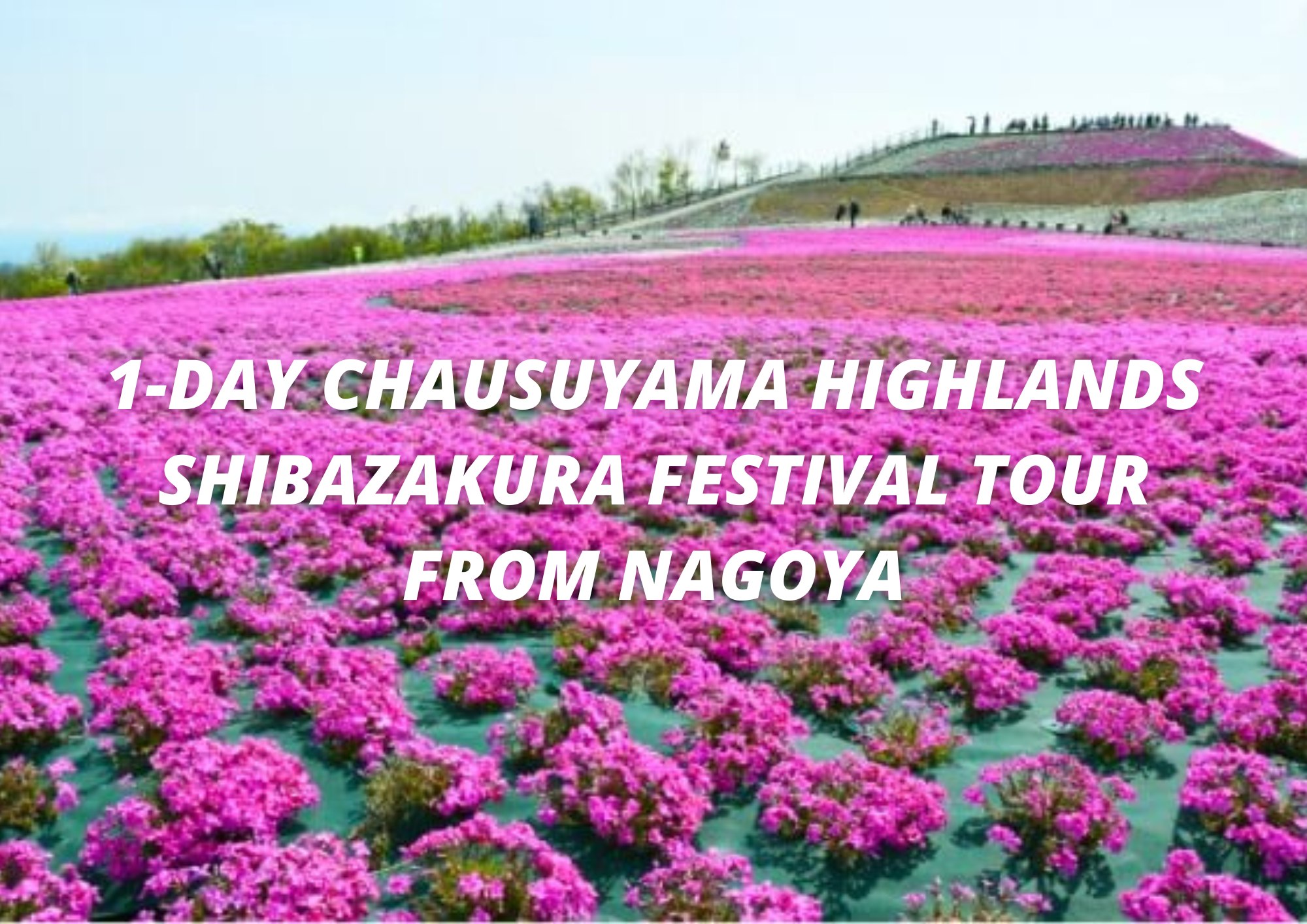
Mt. Chausu
A 1,415 tall mountain and the tallest mountain in Aichi Prefecture. In spring, moss phlox blooms in vast fields on the mountain, and visitors can enjoy six different varieties of moss phlox in different shapes and colors such as pink, white, pale blue and bluish purple. Visitors can also enjoy outdoor activities here year round such as hiking in summer, fall foliage viewing in autumn, and skiing in winter.
Spot details
- Address
-
Toyone village in Aichi Prefecture Kita-kusuga-gun

 Map
Map
- Area
- Oku-Mikawa Area
- Course1
- West Face Climbing Trail: Climb Aichi Prefecture's highest peak and enjoy nature's grand embrace. This area is home to one of the few natural beech forests in the prefecture. The trail starts at the second parking lot and heads toward the summit observatory via Jiyu no Oka, with a climb of about 200 meters. The path is well-maintained, and the first half offers a wonderful view. It's a very popular place with tourists during the moss phlox season. The summit observatory offers a 360 degree panorama view of Okumikawa, the Southern Japanese Alps, and more.
- Course2
- Resort Climbing Trail: This trail toward the summit starts from the Kyukamura Chausuyama Kogen resort, or the fourth parking lot. This is a pleasant, well-maintained trail, with cool winds even in summer. The trail goes through extensive forest areas, and eventually converges with the west face climbing trail. From there, though, is the steepest part of the mountain path. There is also a mountain climbing quiz event. You can pick up a quiz form from the Kyukamura front desk and answer the questions as you head toward the summit. Getting all the questions right earns you a wooden climbing trophy.
- Course3
- East Face Climbing Trail: This trail heads toward the summit from the Yahagi River source entrance via Kaminari Iwa. You can reach the observatory after about 20 minutes climbing the easy, log-step path. The Chausuyama Meisui waters of the Yahagi river source offer one the first spiritual energy zones found on Mt. Chausu. The climbing trail from the summit to the Kaerukan frog house is filled with these mystical power spots. The area around the Kaerukan was found to be a Near 0 Magnetic Field zone. The slope is steep, and there are a few spots where rocks pierce the ground.
Information Sources: NAVITIME JAPAN