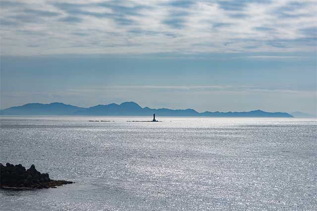
The Seto Inland Sea is the body of water that separates Honshu, Shikoku and Kyushu from each other. This region has a favorable climate all year round as well as plenty of beautiful scenery, clean beaches and several cozy resort towns, making it a popular tourist destination.
-
The Seto Inland sea has a long history as being one of the major sea routes in Japan, serving the major cities in the Kansai area with products and people from places as far away as China and Korea. It used to be particularly busy during the Edo era, as it made up the main transport route between Kansai and Kyushu, a very important route since Kyoto was the capital of Japan back then.
Many major cities are located along the coast of the Seto Inland Sea, including Osaka, Kobe and Hiroshima as well as the smaller industrial hubs of Kure, Fukuyama, Imabari and Niihama.
The eastern end of the Seto inland sea is made up of the coast between Osaka and Wakayama. Its most western point is at the Kanmon Straits, the stretch of water between Honshu and Kyushu. There are waterways connecting the Seto Inland Sea with both the Pacific Ocean as well as the Sea of Japan, contributing to its status as an important shipping route.
Today, the area around the Seto Inland Sea is often referred to as the “Mediterranean of Japan”, thanks to its mild climate and the supposedly relaxed atmosphere of the people living around it. The sea is dotted with over 3000 islands. Some of the more well-known ones are the “art islands” Naoshima, Teshima and Inujima.Naoshima Island 1 day Cycling Tour
¥69,600

Update date:2024/04/20
The Seto Inland Sea has a long history as a famous tourist destination in Japan. Most of the coastal area, including many islands, is part of the Setonaikai National Park. This park was designated as the first national park in the country, back in 1934. It has since then been expanded several times making it the biggest national park of Japan today.
- Setonaikai National Park
-
-

- Hyogo prefecture, Wakayama prefecture, Okayama prefecture, Hiroshima prefecture, Yamaguchi prefecture, Tokushima prefecture, Kagawa prefecture, Ehime prefecture, Fukuoka prefecture, Oita prefecture
-
View All
Washuzan Shimoden Hotel
1666-2 Ohata, Kurashiki-shi Okayama

Public transport in the area is made up by an extensive network of ferries and jetboats connecting the islands to each other. On the islands, public transportation is generally quite spotty – at best you will have access to a few bus lines with sparse departures. However, most of the islands can be conveniently experienced by rental bicycle.
Up until the 1980’s, people traveling between Honshu and Shikoku was bound to do so by boat over the Seto Inland Sea. Since then however, an intricate system of bridges has been built, and today there are no less than three different expressways connecting the two islands. The land connections meant that many of the old ferry lines between the islands have since then gone out of business.
One of roads that links the two islands is the Nishiseto Expressway. It is more commonly known as the Shimanami Kaido and stands out as it is the only expressway between Honshu and Shikoku that allows for bicycle traffic as well. The only rail link between the two islands runs along the Seto-Chuo Expressway and is serviced by the JR Seto-Ohashi Line between Okayama on Honshu and Takamatsu on Shikoku.

 Go here


